ARCHITECTURE PROJECTS BARCH YEAR ONE TWO AND THREE
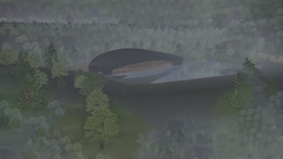
THE BALTIC SEA, HOUSES FOR WATER
a data center, water cleaning facility, public swimming pool and community house
The Baltic Sea is the youngest sea on the planet, almost enclosed, experiencing near-arctic conditions and is one of the world’s largest brackish waters.
In Sweden, households and certain industries in 422 urban areas generate 12.6 million p.e. of waste water every day, which is an amount equivalent to around / 2.52 million kubic meters of water, -25 million bathtubs . Urban waste water is treated in 432 plants across the country before it is discharged.
In a future Baltic, the need to clean water leading from land to to the Baltic will increase. It is suggested to be done with many more, small scale local water cleaning plants with multi functions. So that, by even small or big body of water, in
homes, swimming pools and stremans there is a small plant micro extracting metals, plastic and chemicals from the water. Acting like filter feeders on land the buildings can be public water cleaning plants.

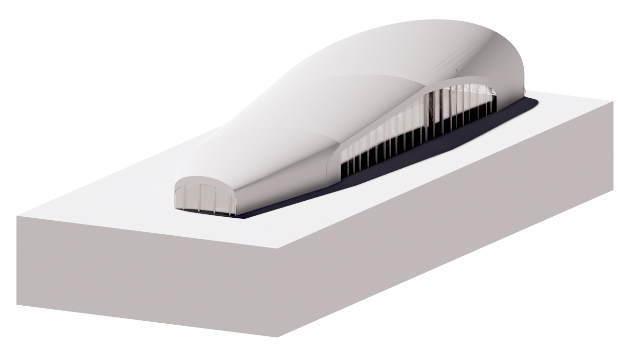
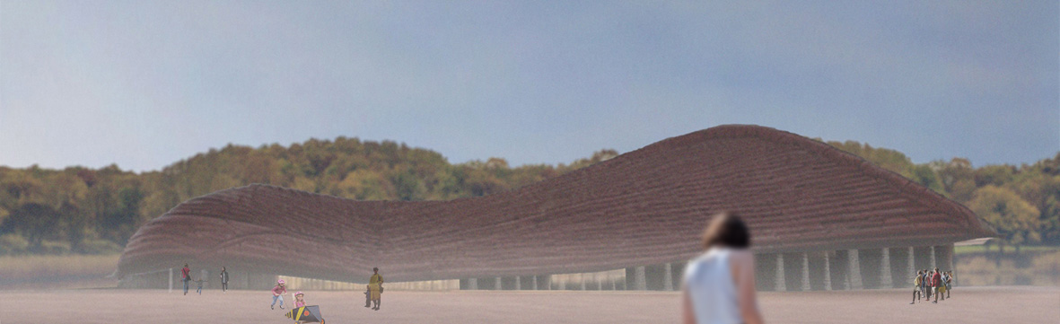
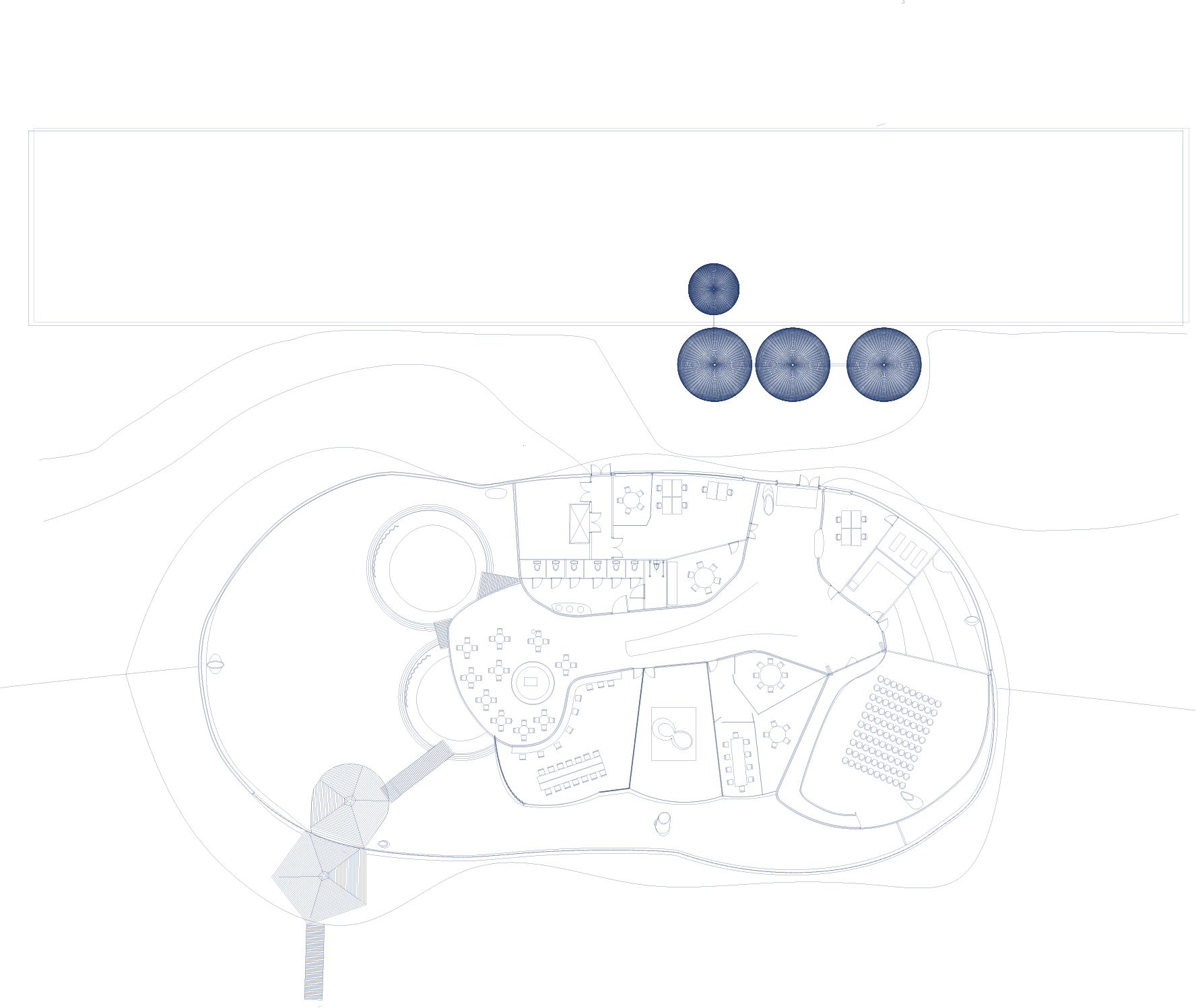
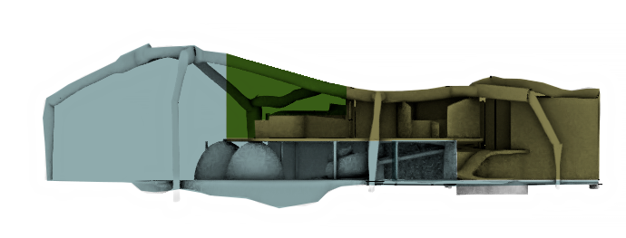
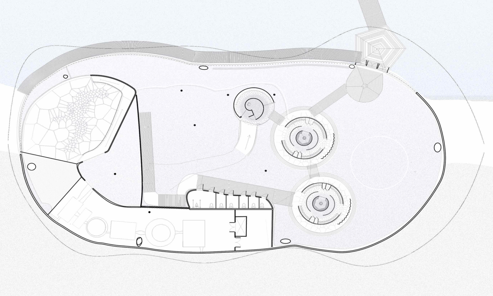
The hybrid building combines the functions of a data storage center, water treatment plant, an under ground bathhouse and a community center with a common cafe surrounding a skateable floor.
It is divided into three floors with a surrounding water tank.
The ground floor hosts the public community centre and skate park. The curved floor is some times also used in the water cleaning process.
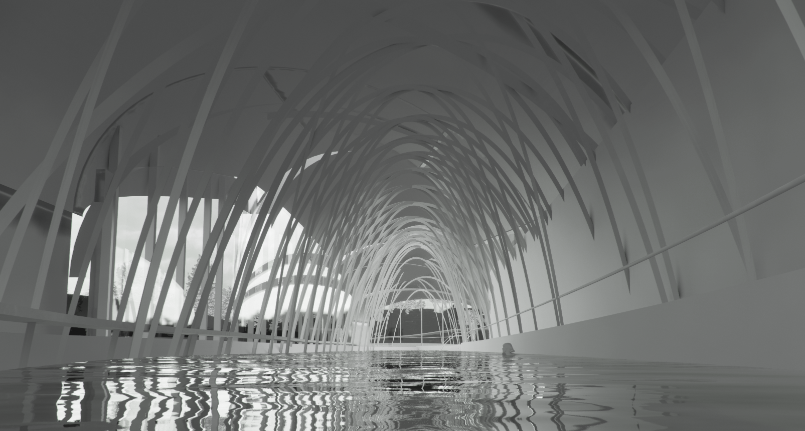
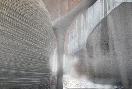
The first floor under ground is where the water can be used by the public for bathing. An indoor lake, chlorine-free, with a sand floor as part of the cleaning process.
Along the walls and in the water room, water flows, trickles, rains, steams, or streams,depending on the rate of water purification. Sometimes, ephermal water walls are created from the water, defining temporary spatial areas within the large water room.
The under ground communal data storage heats the water that is being purified and is part of the a loop-process of heating and cooling.


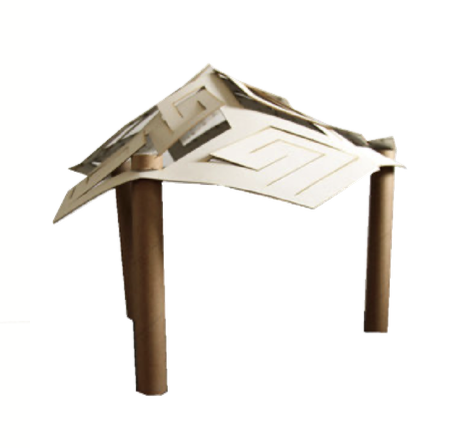
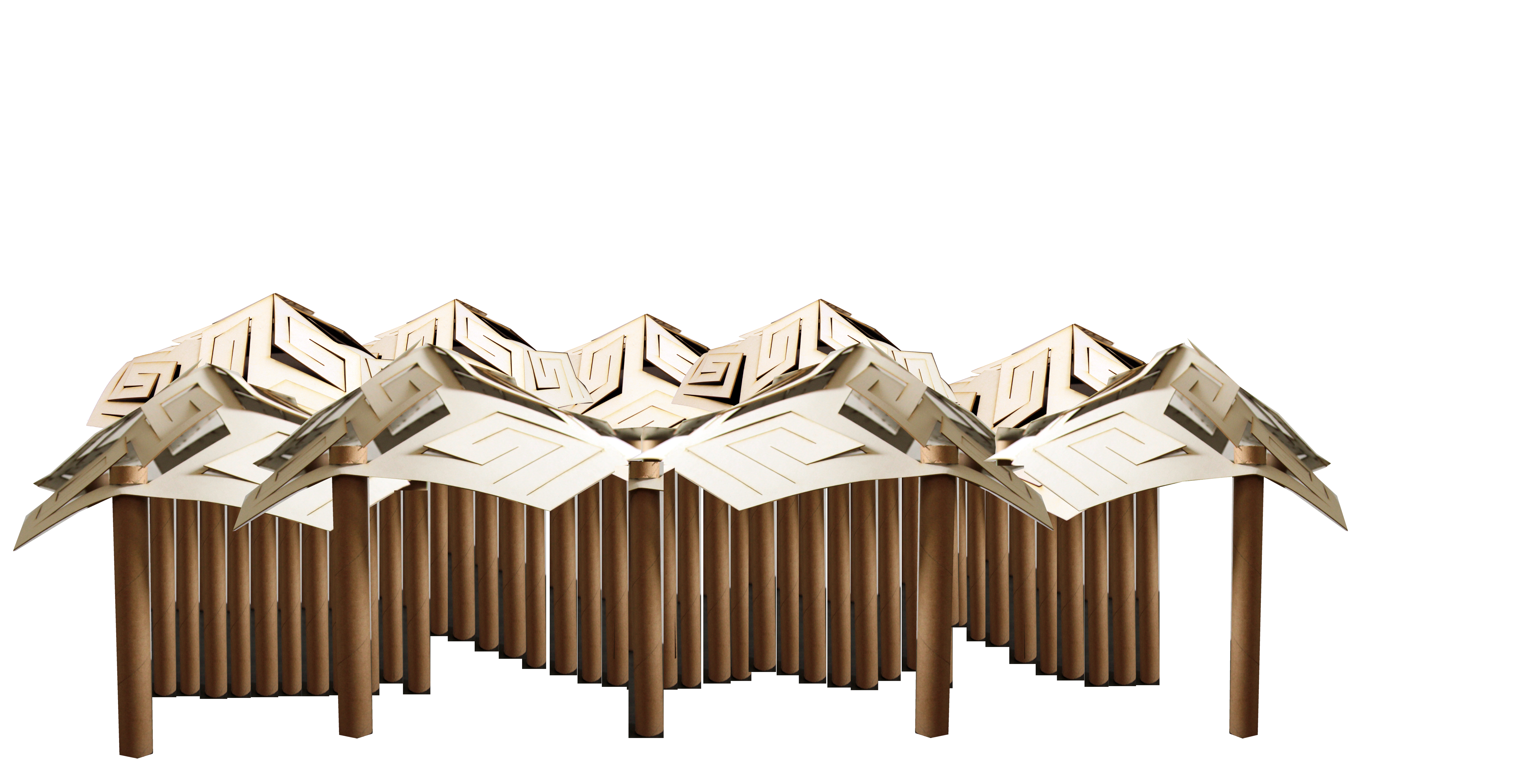
THE STAR FOLD

The star fold is a way to cut a flat surface so that it becomes flexible and foldable. It is a scale free system for making facades, roofs and three dimensional surfaces. The ability to fold depends on the material, and dimensions of the pattern in relation to the strength of the material.


TRIALS IN GENERATING BUILDING IN RHINO/GRASSHOPPER/ENSCAPE


COMMUNITY HOUSE AND PUBLIC SWIMMING POOL
community centre and water building


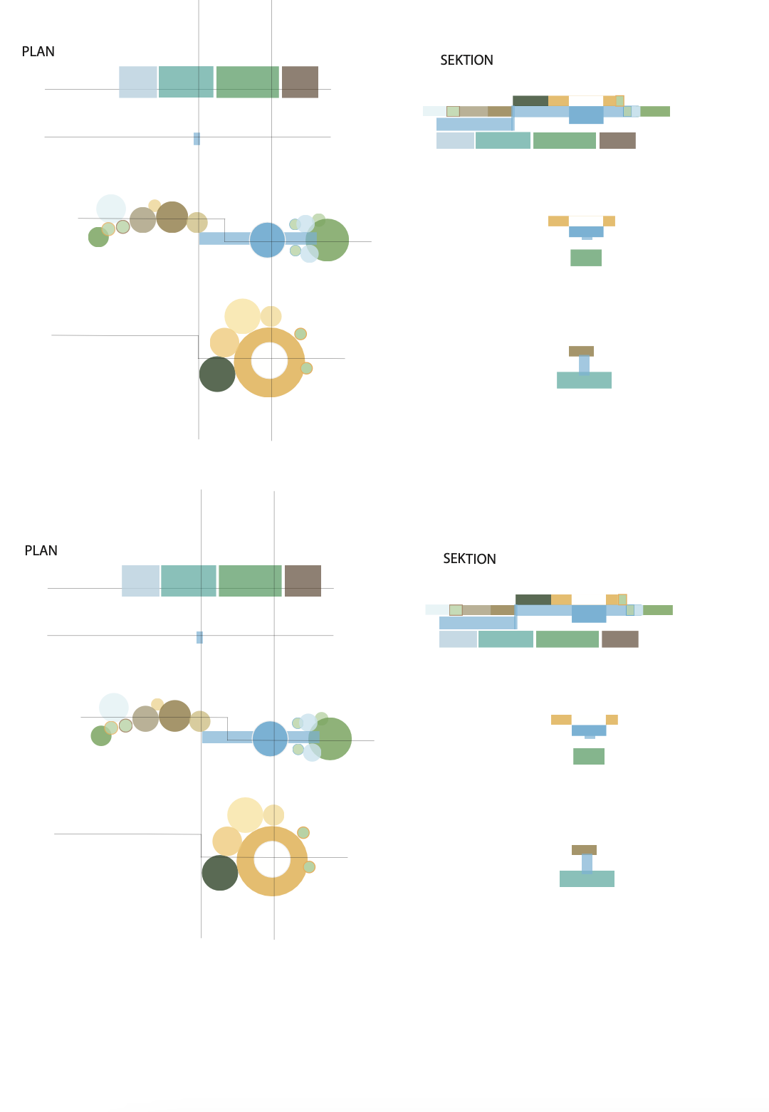
ROOM DIAGRAM AND MATRIXES


WATER CLEANING
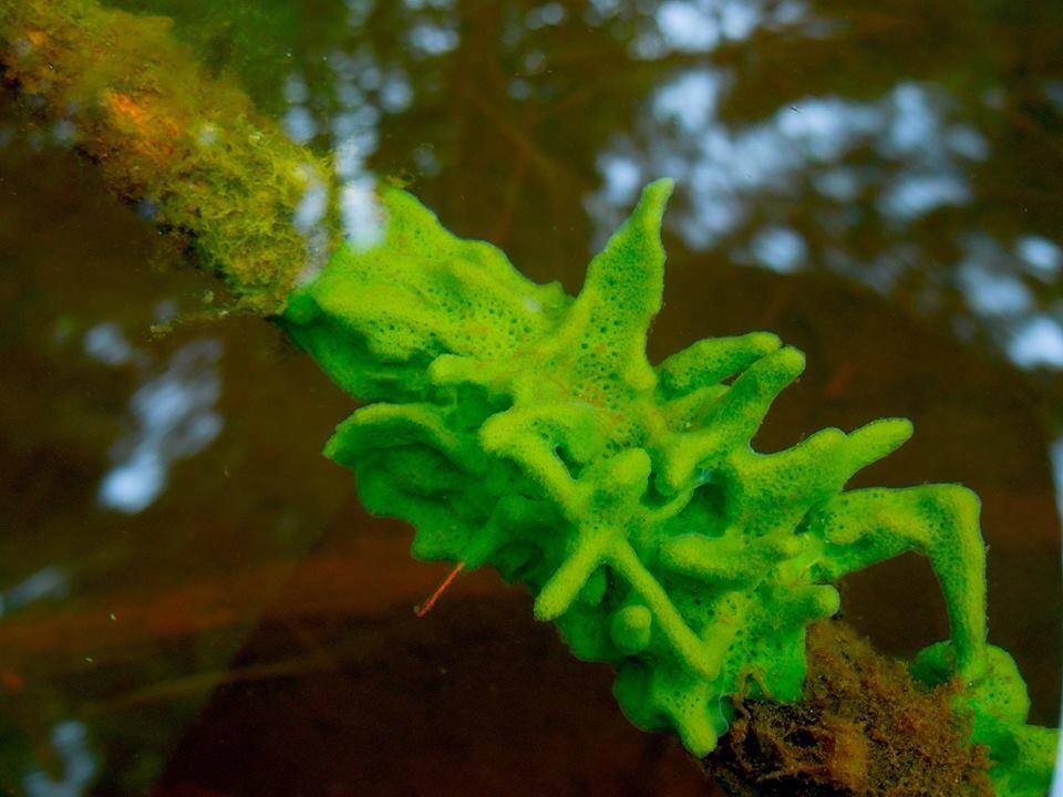
SWEET WATER SEA SPONGE STRUCTURE


EXPERIMENTAL HOUSING


UNEMPLOYMENT OFFICE
Year 2 BArchAn office in the Malmö harbour where unemployed peolpe go to register and spend time, contemplating about times passing.


Chair and illustration of time passing
UNDERGROUND GREENHOUSE HOME


Drawings, floorplans and sections
FOLDABLE HOUSE
VORONOI STRUCTURES AS FOUNDATION FOR FLOORPLAN
While learning grasshopper through tutorials, I got interested in the origin of the Voronoi patterns as they are often used for their ornamental qualities in parametric designs. I recognised them from spatialdivision in data science and geography and thought it would be interesting to use them as a grid-system, instead of using the quadrant-grid-net to potentially optimise the spatial use and break the standard


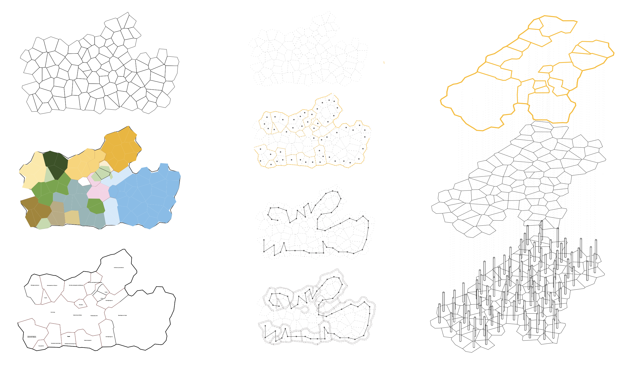


The project explored;
-How to generate floor plans and automate room distribution, non quadrant based.
-If there is a way to optimise space utilisation and movement through data based measures.
-Use the voronoi diagram as a basis for load-bearing structure throughout the building. If used might minimise material use and armature using customised load calculations instead of standard grid.
-Placing points strategically within the floor plan to optimise the spatial organisation in relation to the placement of a 3d-printer.
I didn’t use the method for larger scale spatial divisions but am interested in exploring how to:
-Partition large spaces into functional zones based on specific criteria such as usage, privacy needs, or spatial relationships. -To allow flexible and adaptable layouts that cater to diverse programmatic requirements.
-Base plan on site-specific conditions: topography, space to other buildings and distance to water cleaning facilities.
-Analyze site data and incorporate Voronoi-based design strategies, to create site-responsive design.
THE GREAT ELECTRIFICATION
Mapping and scenario for future regional plan Nynäshamn municipality
Nynäshamn, a harbor city located 10 km south of Stockholm, contains the region’s largest harbor, Norvik, serving as a shipping node for goods and passengers transported from container ships by train to a region with approximately 1 million inhabitants. The key stakeholders in the area include Nynäshamn’s municipality, Stockholms hamn, local inhabitants, and small businesses.
We examined the area from an energy perspective, exploring its potential to become the charging hub of the Baltic region if the ”great electrification” successfully transforms the entire transport sector by 2040.
Based on this analysis, we envisioned a future scenario where electrification initially failed but eventually succeeded over a span of 125 years. In this future, an energy crisis forced society to adopt a local and small-scale approach. Using this scenario and timeline, we conceptualized a new suburb that evolved into a commuter town. A new high-speed train from Stockholm transformed it into a commuter town similar to Yokohama’s relationship to Tokyo
STRUCTURE PLAN
Group work year three, developing a structure plan for a new part of Nynäshamn.

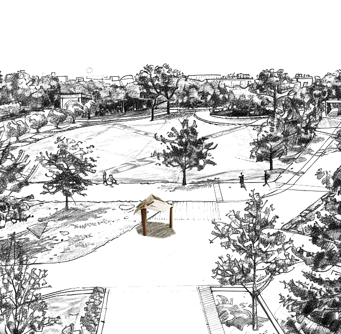
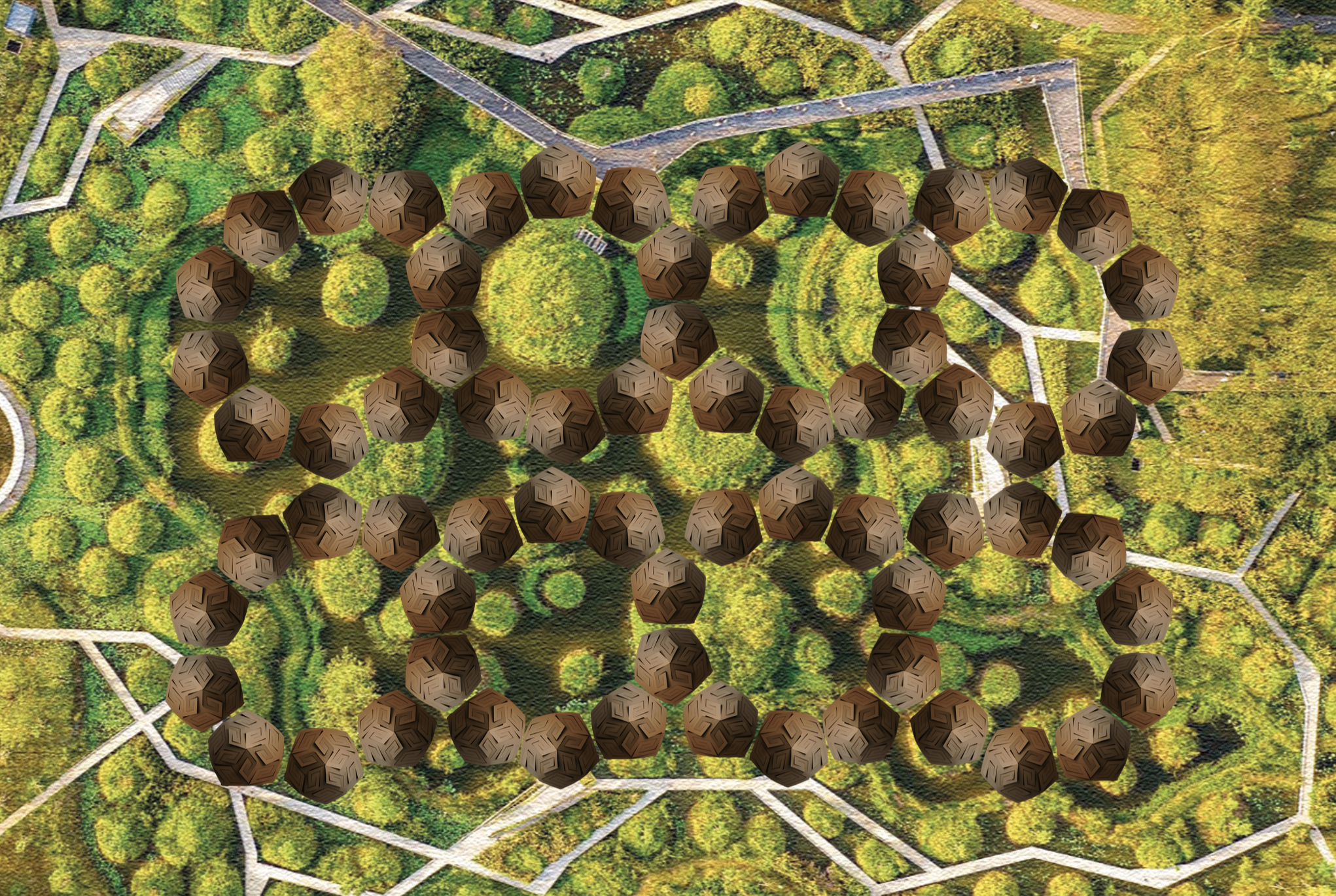
SPORTS PARK AND WETLAND
Proposed establishment of wetlands and a restoration of sports area, with new trails, climbing area and playground,
 Plan sportspark, with lakes and additional illustrations of sites.
 Located in the northern part of Nynäshamn, the area known as Nynäs IP is roughly half the size of Hagaparken in Stockholm or Buttes Chaumont in Paris. It is situated between the main highway (road 73), railroad tracks, and a road for local traffic.
The area is spread around a hill where the local football and hockey teams conduct uphill running, and locals have created an informal rock-climbing site. The southern part of the area is less frequented and includes rundown fields for spear-throwing, discus, and archery shooting. A group of beavers has built dams in the stream bordering its edge. This stream carries water from the lake ”Älgviken” and the artificial wetlands on the northern side of the highway.


New lakes
The new lakes will take advantage of that the grounds are the lowest located and holds the most ground moisture to establish two wetlands and lakes. It is where the public swimming pool combined with water cleaning plant will be.
Trails from movement data
By extracting the movement data from the training app Strava when used in the area, gave formal and informal paths. Togeher with site visitis they were overlayed over maps and combined with on site mapping, new paths were designed in the southern parts.


PROMPTED DESIGN
COLLABORATION


RHINO/GRASSHOPPER GEOMETRIES


SPACE STATIONS
3d printed prototypes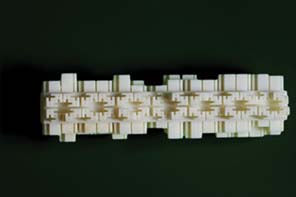


Rhino Oblique
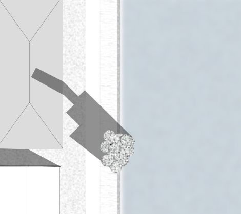
 Section public toilet